THE BUSINESS
The City of Detroit – Department of Public Works provides environmental and infrastructure services to ensure safe and efficient mobility for the residents, visitors, and customers of one of the country’s most populous cities. The Department is tasked with engineering, design, construction and maintenance for thousands of miles of streets in a notably harsh climate that exacerbates pavement wear and tear.
THE CHALLENGE
The Department was seeking an innovative technological solution that could support its preventative and ad-hoc maintenance planning and prioritization by providing roadway surface data in a timely, objective and effective way. The Department needed to improve the frequency and objectivity of road
condition data collection and obtain automated analysis results.
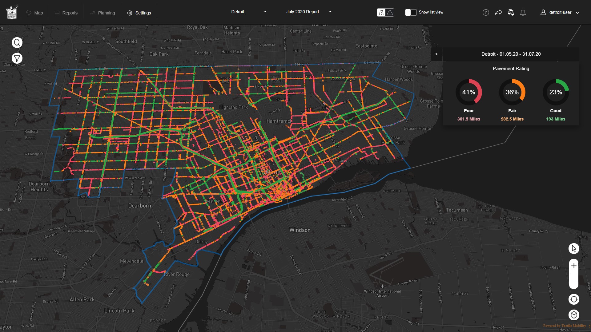
Specifically, the Department was seeking a reliable, cost-effective, and automatically updated pavement rating score on a 10-grade scale (correlated to the PASER scale). This solution would need to rate each municipal road segment, including those in residential areas, which were not surveyed due to budget considerations.
Existing survey methods relied on a traditional survey vehicle that could only operate once every 18-24
months on primary and collector roads owing to the expense, as well as a visual assessment conducted by the Department itself, which was subjective. Both methods provided data that was accurate only for a very limited window of time after the survey.
THE SOLUTION
The City of Detroit Department of Public Works chose Tactile Mobility, in partnership with a major Detroit-based automaker, to continuously and accurately measure and deliver highly updated PASER-correlated pavement rating, to automatically locate potholes, and to recommend locations for asphalt patching.
Tactile Mobility’s data collection and crowdsourcing technology was onboarded in 20 of the automaker’s vehicles, which are owned by the City. Each in-vehicle Tactile Mobility aftermarket device is connected to the vehicle’s computer network and interfaces with the company’s cloud-based system. The system
generates insights about vehicle-road dynamics, with an emphasis on characterizing road attributes such as grades, banks and curvatures, and road conditions such as slipperiness and hazard location. The software offers a near real-time physical and functional view of the road network to support responsive and planned maintenance, live distress detection, and post-accident analysis.
THE BENEFITS
The Tactile Mobility-equipped vehicles act like real-time sensors on the streets of Detroit – continuously monitoring and reporting the quality and conditions of each road segment to stakeholders and providing an ongoing, 24/7 objective map of Detroit’s road conditions.
The high correlation between Tactile Mobility’s pavement rating and current standards exceeded the
Department’s targets. Today, the city is better able to prioritize preventative maintenance and more
effectively direct ad-hoc corrective maintenance.
Moreover, the city will also be able to detect areas of slipperiness such as ice, puddles or additional weather-related elements in real-time and transmit the information to control centers that alert drivers
before they reach affected areas.